A day on the Mont, told by the tide
The abbey does not change with the tide. Almost everything around it does — what you can walk on, what you can photograph, and how the crossing feels underfoot.
-
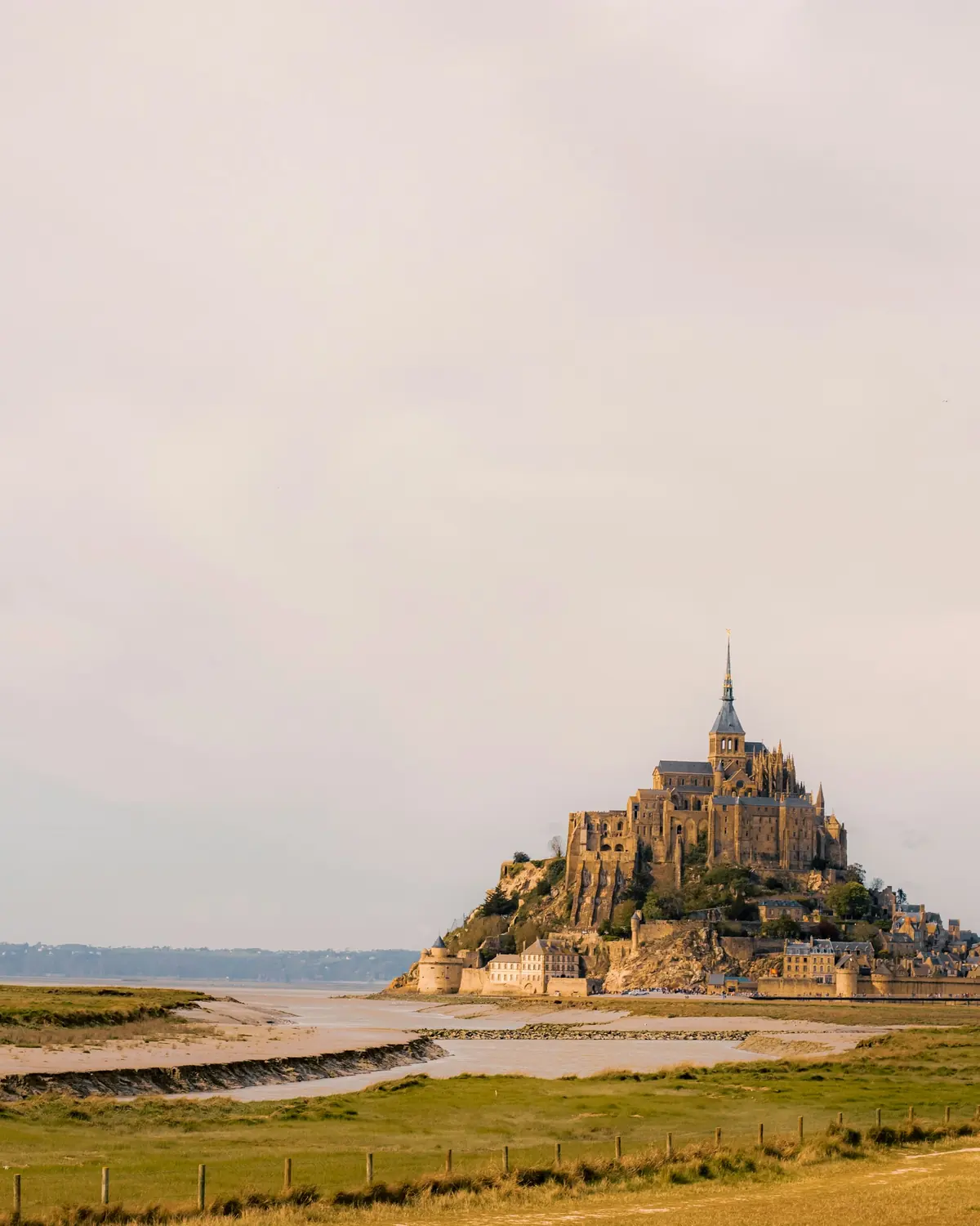
Low water · Morning
The bay empties
Twice a day the sea pulls back across the flats around the rock, leaving wet sand criss-crossed by river channels, the Couesnon's among them. This is the bay medieval pilgrims crossed on foot: a granite island standing clear of the sands.
-
The causeway
Crossing the bridge
From the mainland car parks, about 2.5 kilometres from the rock, the free Le Passeur shuttle takes around 12 minutes; walking the same route takes 40–50 minutes. The last stretch crosses Dietmar Feichtinger's bridge, opened in July 2014, which lets the tide flow around the Mont instead of blocking it like the raised 1879 causeway it replaced.
-
The Grande Rue
The climb begins
Through the Porte de l'Avancée, the Grande Rue climbs in cobbles past half-timbered houses and the parish church of Saint-Pierre, then on to the Grand Degré staircase. The abbey's own access notes say neither the village nor the abbey has ramps or lifts, so every visitor makes the climb on foot.
-
The abbey terrace
The abbey at the summit
The Grand Degré, around a hundred steps, ends at the abbey entrance, and the west terrace beyond it opens onto the bay. The church crowns the rock on a platform of crypts, while La Merveille — the Gothic monastic buildings raised after a 1204 fire — stacks its cloister, refectory and halls on three levels along the north side.
-
The ramparts
The rampart walk
A walkway follows the village walls from near the entrance up toward the abbey, a different angle on the bay at every turn. It is the best vantage point for watching the water decide what it is going to do next, and an alternative to the Grande Rue on the way up or down.
-
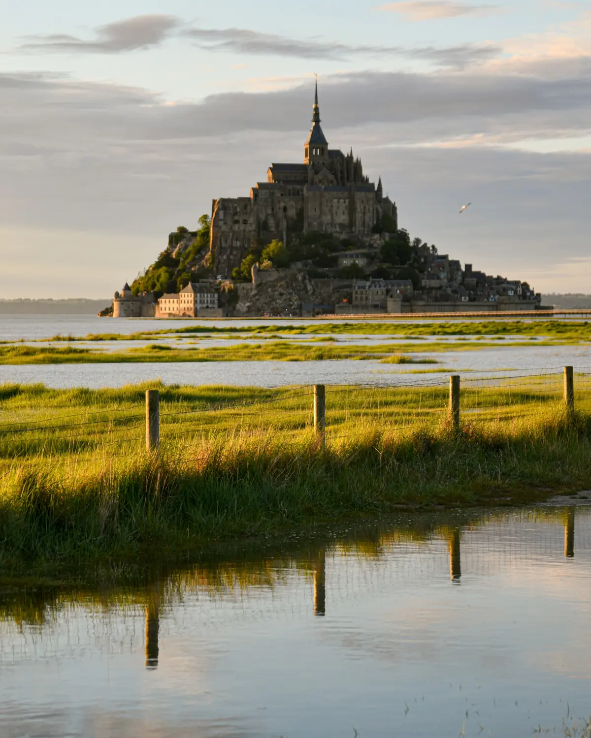
High water · Evening
The sea comes back
The tide comes back across the flats, filling the channels and, on the strongest grandes marées around the equinoxes, rising far enough to cover the bridge approaches. Most days it simply refills the bay below the ramparts while the village lights come on above it.
Tide times and coefficients for the bay are published well in advance by SHOM, France's hydrographic and oceanographic service, and the Mont-Saint-Michel tourism office republishes the high-tide dates in a visitor-friendly format — worth checking before you fix a time of day.
What the tide decides, and what it doesn't
The bridge changed the question
From 1879 a raised causeway road ran to the foot of the Mont, and the bay silted up around it. The bridge that replaced it in July 2014 sits on slender piles that let seawater flow beneath, so on an ordinary day the crossing is open at any hour — the tide decides what the bay looks like, not whether you can get there.
Walk out, ride back
The free shuttle, Le Passeur, covers the route from the mainland car parks in about 12 minutes and runs from early morning until late evening. Walking the same stretch takes 40–50 minutes and is the better way to arrive, since the abbey grows in front of you the whole way; plenty of visitors walk out and take the shuttle back after the climb.
The climb has no shortcut
From the village gate to the abbey entrance is a steady climb on cobbles and steps, and the visit inside adds many more across the abbey's three levels. The abbey's own access notes say there are no ramps or lifts in the village or the abbey, and the cobbles get slick in rain or sea mist — visitors with limited mobility should read the abbey's accessibility page before planning the climb.
Grandes marées are a calendar event, not a surprise
French tide tables rate every tide on a coefficient scale from 20 to 120, and the strongest — the grandes marées — cluster around the March and September equinoxes. The coefficients are published well in advance, so a date with water over the bridge approaches can be planned for rather than stumbled into.
Planning guides
Timing
The best time to visit Mont-Saint-Michel
Season, time of day and the tide calendar — and how the three line up.
Read the guide →Family visits
Mont-Saint-Michel with kids
What the climb actually involves, and how to make it work for younger legs.
Read the guide →Getting there
How to get to Mont-Saint-Michel from Paris
Train and shuttle, the coach option, and what each actually takes.
Read the guide →Photography
Photographing Mont-Saint-Michel from the mainland
Where the classic shots are taken, and why the tide matters more than the lens.
Read the guide →Monastic life
Mass and monastic life at Mont-Saint-Michel today
Who lives and prays in the abbey now, and what a visitor can expect to see.
Read the guide →Inside the abbey
What to see inside Mont-Saint-Michel abbey
The Merveille, the cloister, the crypts — and how long to allow for the abbey.
Read the guide →Tides and the causeway
Mont-Saint-Michel tides and the causeway, explained
The coefficient system, the 2014 bridge, and what a grande marée actually is.
Read the guide →The ramparts
Walking the Mont-Saint-Michel ramparts
The walkway along the village walls, and why it beats the Grande Rue for views.
Read the guide →Questions before you go
Is this the abbey's own site?
No. This is an independent guide to visiting Mont-Saint-Michel, with no affiliation to the Centre des monuments nationaux, the body that manages the abbey and publishes its own visitor pages. Booking links here go to Viator; when one turns into a sale, Viator may share a slice of its own margin with this site, and the figure on your screen doesn't move either way. The abbey's operator keeps its own visitor pages atwww.abbaye-mont-saint-michel.fr/en.
Does the tide ever cut the Mont off?
Only on the strongest days. Since the 2014 bridge opened, the crossing stays passable on an ordinary tide because the structure lets water flow beneath it. Only when the tidal coefficient climbs past roughly 110, mostly around the equinoxes, does water rise far enough to reach the bridge approaches and briefly turn the Mont back into a true island.
How do I get from the car park to the village?
All visitor parking sits on the mainland, about 2.5 kilometres from the rock. From there it's a free shuttle ride of about 12 minutes, or a walk of 40–50 minutes — plenty of visitors do one each way.
How long should I plan for a visit?
Half a day covers the crossing, the climb and a self-guided look inside the abbey; the abbey's own notes put the walk from the car parks to its entrance alone at 45 minutes to an hour. A full day leaves room for the rampart walk, the Grande Rue, and watching the tide move across the bay from a different point in its cycle.
Can I walk out onto the sand of the bay?
Not without a qualified bay guide. The bay hides genuine quicksand and the tide advances faster than it looks, which is why medieval pilgrims crossing the flats called the place Saint-Michel "au péril de la mer" — in peril of the sea. Guided bay walks exist and run from villages around the bay, but wandering onto the flats alone is not something this guide can recommend.
What's the best time of day to go?
Early morning and late afternoon are usually calmer than the middle of the day, when most day-trip coaches are on the rock. An early or late visit also lines up better with a changing tide, which is most of the point of coming.
Is it a realistic day trip from Paris?
Yes, though it is a long day: a TGV from Paris-Montparnasse to Rennes followed by a connecting bus adds up to roughly three to four hours each way. Viator's day trips bundle the whole journey into one booking, which is why they are the most-reviewed Mont listings there.
- Cancellation terms shown first Viator lists the cancellation window on each tour before you pay
- Secure checkout Payment is handled on Viator's own checkout, not on this site
- Nothing added on top Viator sets the figure you see; this guide doesn't mark it up in either direction
- Checked against the operator Practical facts on this site are checked against the abbey's own pages before they're published
Ready to look at dates
Current Viator listings for Mont-Saint-Michel
See dates and tours on Viator ↗